Three student authors, Gauthier Guerin, Paul Alberto Jarrin Tamayo and Solvi Thrastarson, have jointly won the 2022 Geophysical Journal International student author prizes. The
winning authors each received a cash prize and a certificate of recognition.
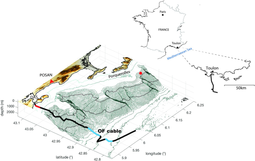
Gauthier Guerin’s paper, “Quantifying microseismic noise generation from coastal reflection of gravity waves recorded by seafloor DAS”, where DAS is distributed acoustic sensing, paves the way for the use of DAS data to monitor ocean-solid Earth interactions. The authors take advantage of a 41 km long submarine optical fibre cable off the coast of Toulon, France, to record both the amplitude and frequency of seafloor strains induced by ocean surface gravity waves, as well as secondary microseisms caused by the interaction of gravity waves incident and reflected from the coast. Read about their findings at https://academic.oup.com/gji/article/231/1/394/6595879.
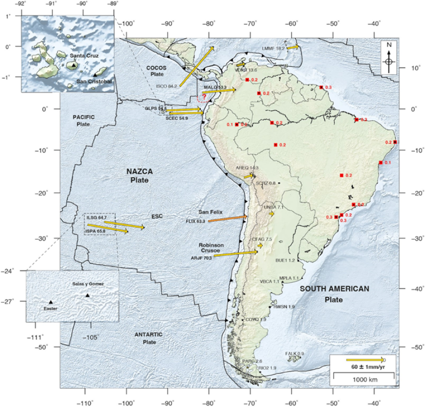
Paul Jarrin’s paper is entitled “Current motion and deformation of the Nazca Plate: new constraints from GPS measurements”. Using continuous GPS monitoring from six sites, the authors determine relative movement along the plate boundaries, as well as consider the non-closure of the Pacific-Cocos-Nazca Plate circuit. Read more at https://academic.oup.com/gji/article/232/2/842/6695092
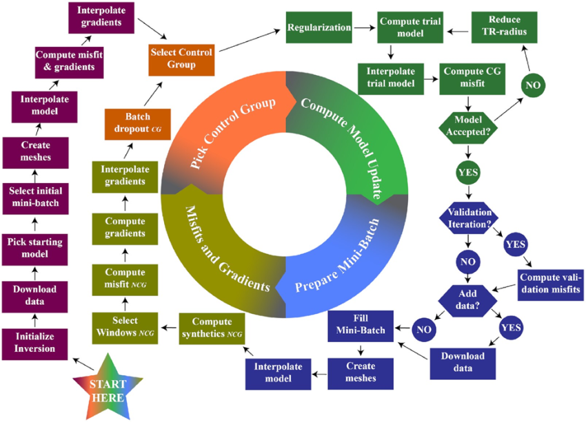
Solvi Thrastarson’s paper, “Data-adaptive global full-waveform inversion”, presents a novel approach to global-scale full-waveform inversion (FWI) that, the authors say, can reduce computational cost by over an order of magnitude, compared to previously published methods, without sacrificing physical and mathematical rigour. The authors present the LOng-Wavelength Earth model (LOWE) as the first global FWI constructed entirely from a spherically symmetric initial mantle structure as a showcase for the method. Read more at https://academic.oup.com/gji/article/230/2/1374/6554245