GJI_2.png
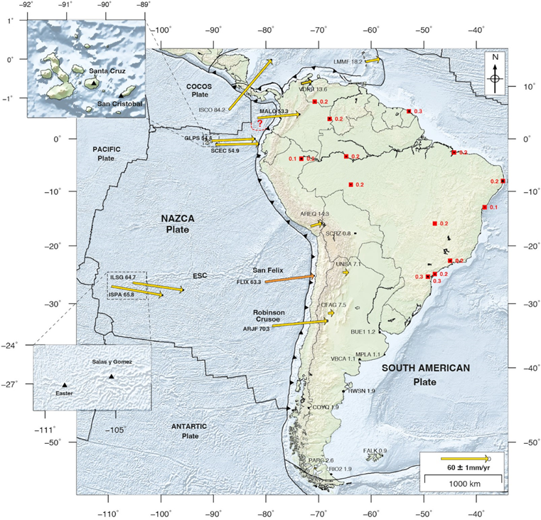
Map of the GPS stations used to define the stable South America (SOAM) reference frame. Red squares are sites used to compute the SOAM pole. Yellow arrows are velocities relative to SOAM reference frame. Ellipses show 95 per cent confidence. Red dashed line is the Malpelo microplate boundary proposed by Zhang et al. (2017). Black triangles in the inset plots show the location of GPS at Easter, Salas y Gomez, Santa Cruz and San Cristóbal islands. Orange arrow is the velocity reported by Kendrick et al. (2003) at the San Felix Island. ESC, Easter Seamount Chain.
Jarrin et al.
Licence type