GPS observations of ground movement under the Eifel area
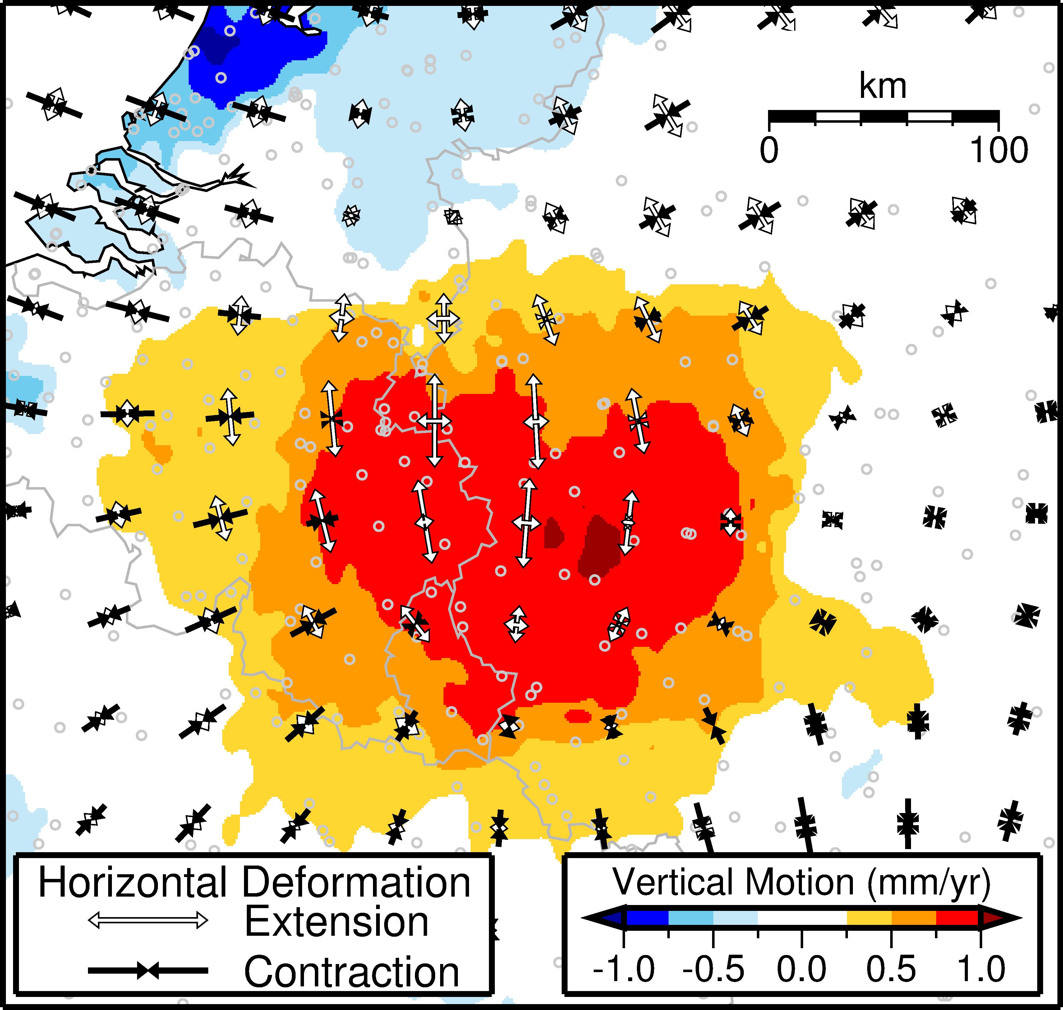
GPS observations of ground movement under the Eifel area. Colours represent contoured vertical motion inferred from GPS station data, and white and black arrows indicate the direction in which the crust is horizontally stretching or compressing, respectively. The highest upward motion of ~1 mm per year is found near the Eifel Volcanic Field.
Corné Kreemer / University of Nevada, Reno
Licence type